Then it was a 10 hour bus ride to a wee town called Güicán, along a gravel road in a nice wee valley:


We got to Güicán in the evening and found a hotel, who also hooked us up with a guide who would rent us a tent, gas stove, and sleeping bags for the others. The plan for the morning was to breakfast, buy 1 or 2 last things, go to the office to register our intention to go to the park and pay the entrance fee, and be on our way by 12pm. In the end we got to the office at 11:46, one minute after the start of the lunch break. "What a shame for you guys." So we did fuckall for an hour while we waited:

El Cocuy, from outside the National Park office.


Bottle caps from "Poker" beer. They're everywhere.
The guy in the NP office told us we could take a more off-road route than the one planned for the first day, with his instructions being something like "follow that road, and before it reaches the bridge and crosses the river, take a path to the left. There's another bridge further up." Naturally we took the wrong path from the road and got lost for about an hour in a farm, after the trip's first "selfie-time" (the trip was mostly Spanish-language, but "selfie-time" was always as shown):


Finally we returned to the road and asked for directions, from some fortuitously-present locals. After we got going it turned out to be a pretty nice walk:


Having a wee rest before finally crossing the river.


Güicán in the distance.

In the end after being delayed at the office and the farm, we ended up camping in a random field (we weren't yet in the park, where you can only camp in designated spaces, and someone assured us the farmer wouldn't have any beef):


Selfie-time before bed. The only that wasn't washed out and doesn't have closed eyes. How hard can it be?
The next day we had to make up the distance from the first, as well as walk the planned second day. So we got up fucking early.


Destination: somewhere up on the right.


Lotta omelettes.

Upside-down pine tree?!

Approaching where we were supposed to stop the night before, up that valley was the next leg.

Refugio we'd planned to camp next to, but which served as a nice coffee stop. Also one of the sleeping bags we hired was actually a sleeping bag-bag full of clothes, so we got an actual sleeping bag sent up in the morning with the milk truck. The owner also showed us around a bit and told us about the house. He was pretty excited to inform me that he has sheep from NZ, and showed me a photo. I assumed we'd see some on the walk so didn't photo the photo, but we didn't in the end...

A group of Japanese people that stayed in the park in the 70s or 80s. I believe he said they stayed for 20 days, and then sent this photo with another from Tokyo.

Started the day somewhere on the dark splotch on the far left, I believe.


Cows are curious. This one was nosing my pack when I left it on the ground.


View from above the valley, which comes up from the right.

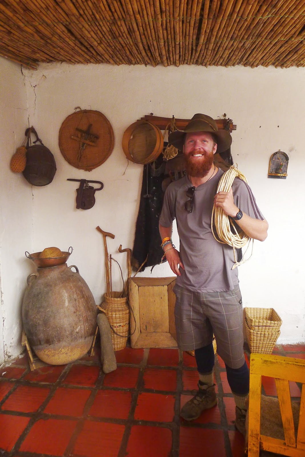
Inside of house made of frailejón (more on them later).


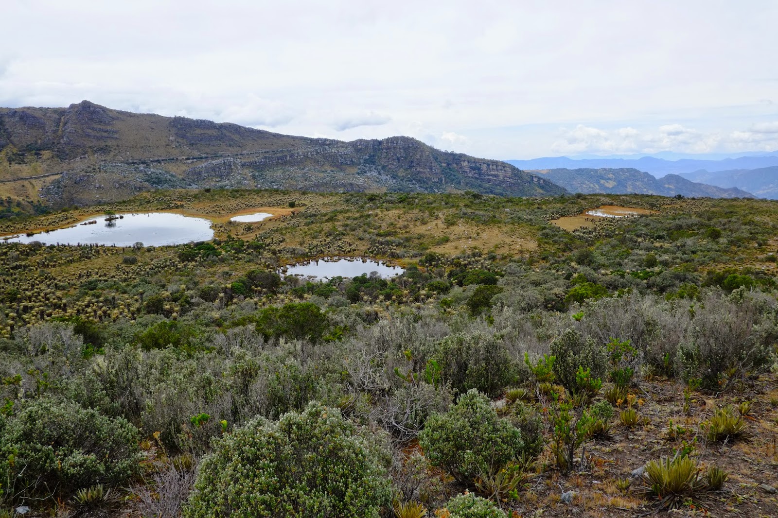
First frailejones we saw. These guys only live at high altitudes in a type of ecosystem called páramo, and act a little like cactuses, storing water for large periods of time. They grow at the jaw-dropping rate of 1cm/year.

Bebe frailejón.
View from the lunch spot.


Post-lunchtime selfie-time.

Destination: white house top-centre.


Lake just around the corner from the camp site.

Test with bumped tripod.

Fuck the universe is cool.
We didn't end up getting up that early the following morning, having changed the plan from "carry all our stuff all day to camp next to a lake where it'll be colder than here" to "carry some food and clothes and walk up to see the lake then return to camp." The altitude and cold hadn't been kind to our attempts to sleep... So after the sun was well up, we set out.

The campsite was in the shadow of the exact peak when the sun rose.


The valley we walked up the previous day. Lodge to the left, valley to the first lodge to the right somewhere.


Lodge/campsite somewhere almost dead-centre.

Target: that steep mofo on the right.

Once we got to the top of the pass, we found ourselves on this seemingly-neverending broken up rock slab.

The initial plan was to talk up along the snowline somewhere on the left, and around to a big lake. Failing that, we wanted to walk up, see the lake from above, and return. In the end we walked up as far as we could be bothered on the rock slab, lunched, and returned.

Selfie-time with ear-warming scarf turban.


"Guys, come, the photo of the century is here."


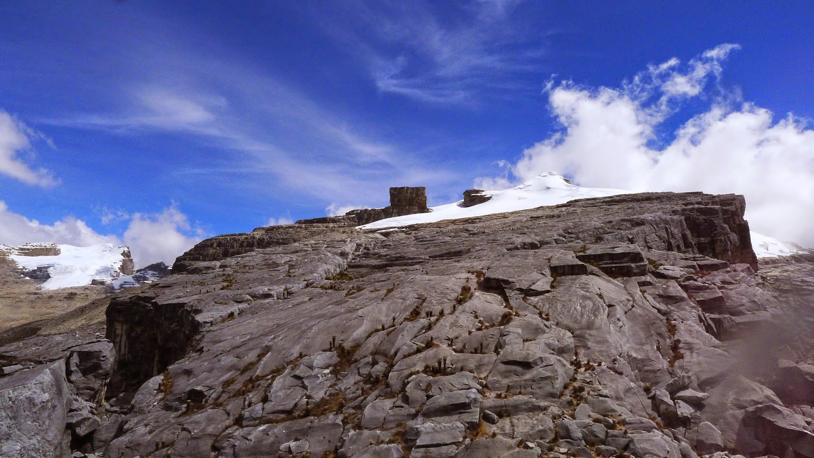
The rock in the middle is called the "Devil's Pulpit," we were originally going to skirt around the bottom of it somewhere.

The highest we got to. We were camping at about 3900m, and were told that at the campsite it could get to -5°C or so.

Another lunchtime selfie-time.


This guy's pretty old...


Sprouting frailejón.


After our walk, we cooked one of the dinners for lunch, packed all our stuff up, and walked an hour and a bit to the place we were getting picked up for one last selfie-time:


Three peoples' lives.
The following morning, we walked around the town a bit, marveling out how time seems to stand still in tiny places like this on weekends. Small town folk know how to live. We then walked to some natural hot swimming pools to relax a little.


Thanks to Marjorie and Nico for their company (and photos!), we may've only seen almost nothing of the park, but it was fucking amazing nonetheless!